

RCD TAC reaches 100-site milestone in Newfoundland and Labrador heritage preservation
By Allison Rowe | CNA Currents
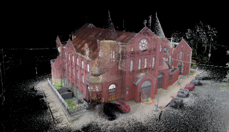
There is a moment, just after a laser scanner begins its silent sweep, when a centuries-old building is transformed into millions of precise digital points. Every timber beam, every worn stone step, every curve of a church arch is captured in extraordinary detail.
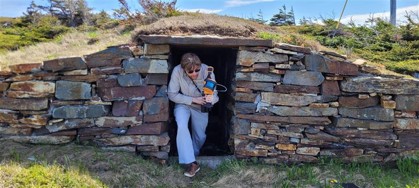
From the windswept root cellars of Elliston to the soaring interior of Fogo United Church, College of the North Atlantic’s (CNA) Reality Capture and Digitization Technology Access Centre (RCD TAC) has spent the last three years building a digital archive, a 3D trove of Newfoundland and Labrador’s treasured heritage, one scan at a time. (Check out the live 3D digital scans and flythroughs under ‘Bringing heritage to life’ section at the end of the article).
Dr. Michael Long, CNA’s Dean of Applied Research and Innovation and Atlantic Canada’s Board of Directors Representative for Tech Access Canada (the national network representing Canada’s Technology Access Centres) explained the significance of this remarkable milestone. “The achievement of scanning 100 registered heritage sites represents far more than a number. It signals a growing movement to safeguard our cultural landmarks using some of the most advanced reality-capture technologies available today,” said Long. “Heritage sites are increasingly vulnerable to wildfires, extreme weather, and the broader impacts of climate change. As we have seen with the recent loss of historic structures in the province due to fires, these digital records are becoming essential to preserving our collective heritage for future generations.”
Supported through a federal Mobilize grant from the Natural Sciences and Engineering Research Council of Canada (NSERC), the project has brought together RCD TAC researchers, staff, students, Heritage NL, local heritage organizations, municipalities, and community members in a province-wide effort to create detailed 3D digital replicas of historic buildings, churches, bridges, landscapes, and culturally significant spaces.
Led by Heather Ward, Director of RCD TAC, the initiative uses advanced reality-capture technologies including LiDAR scanning, photogrammetry, drones, 3D Gaussian Splatting, and 3D modelling to preserve the structures and sites that tell the story of the province’s people, communities, and traditions. “Every building has a story, and every scan helps ensure that story is not lost,” said Ward. “This milestone demonstrates how emerging technologies can serve heritage preservation in meaningful ways. We are creating digital records that can support education, cultural tourism, restoration projects, accessibility initiatives, emergency planning, and future research.”
The technology behind the preservation
RCD TAC uses a suite of advanced reality capture and digitization technologies to create highly accurate digital replicas called “digital twins” of buildings and environments.
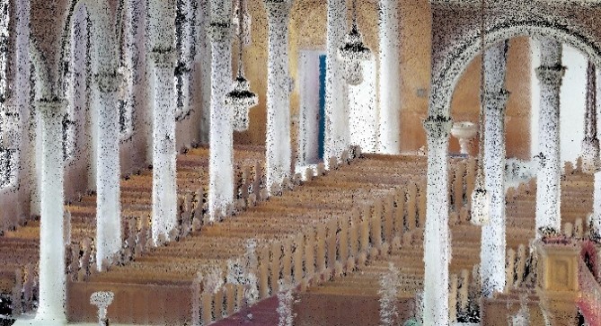
LiDAR scanning
LiDAR (Light Detection and Ranging) uses laser pulses to measure distances with millimetre-level accuracy, producing dense 3D point clouds that capture the exact geometry of a structure. It is particularly valuable for documenting historic interiors, complex architectural details, and buildings that may require future restoration work.
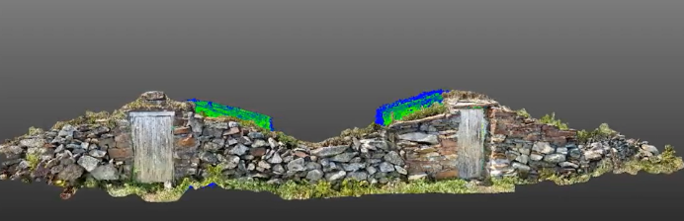
Photogrammetry
Photogrammetry combines hundreds of overlapping photographs to generate detailed 3D models and high-resolution textures. This technique is ideal for capturing exterior surfaces, landscapes, and decorative elements while preserving realistic colour and material information.
3D Gaussian Splatting (3DGS)
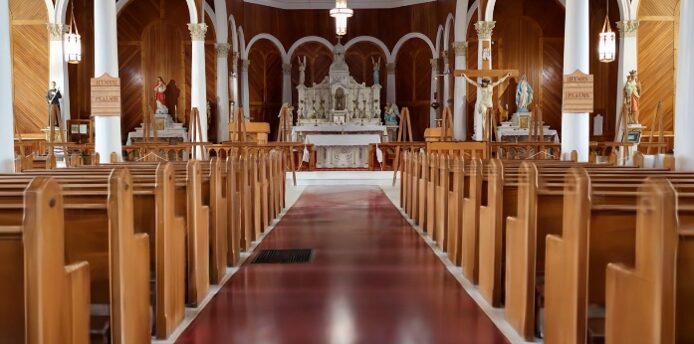
3D Gaussian Splatting (3DGS) is an advanced 3D visualization technology that transforms photographs and scan data into highly detailed, photorealistic digital models. By using millions of data points to recreate real-world environments, it allows heritage sites, buildings, and landscapes to be explored virtually with exceptional accuracy and realism.
Drone-based mapping
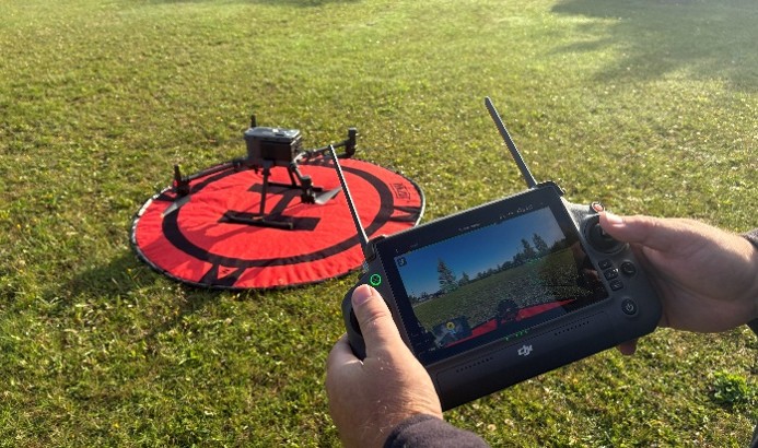
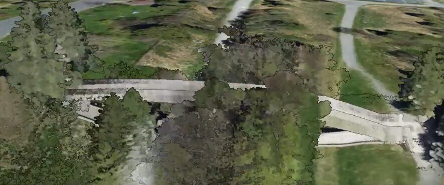
Drone-based mapping uses unmanned aerial vehicles (drones) equipped with high-resolution cameras, LiDAR sensors, and other imaging technologies to collect detailed spatial data and create accurate maps, digital twins, and 3D models. Drone-mounted sensors can safely capture rooftops, towers, bridges, coastlines, and other hard-to-reach areas without disturbing fragile structures, providing comprehensive documentation for conservation planning, architectural analysis, repairs and more.
A province mapped in 3D
As the number of scanned heritage sites continued to grow, RCD TAC recognized the need for a centralized tool to organize, track, and share this valuable information. In response, the team developed an interactive digital heritage map that has become a cornerstone of the project. Drawing from a comprehensive database of more than 850 heritage structures, landscapes, and districts across Newfoundland and Labrador, the map brings together site locations, heritage designations, historical descriptions, and digital assets in one accessible platform. Created early in the project to support planning and fieldwork, the database and mapping system have evolved into a powerful resource for heritage researchers, communities, and preservation professionals.
By connecting users to detailed information and immersive 3D scans, the growing digital archive helps safeguard the province’s built heritage and ensures these important cultural landmarks can be explored, studied, and appreciated for generations to come. To learn more visit: https://experience.arcgis.com/experience/7a3119986b04404f871b41906379772f
Our Lady of Mercy Church Digital Kiosk
One of the most recent successes of the RCD TAC in digital heritage preservation was the launch of an interactive digital heritage kiosk at Our Lady of Mercy Church in Port au Port. Visitors can now explore the church’s architecture and history through immersive digital content developed by RCD TAC. This project also demonstrated the practical value of reality capture technologies for heritage conservation. RCD TAC’s initial detailed digital and drone-based scans of the church were used to support successful applications for approximately $600,000 in ACOA and IET funding, helping secure resources for critical renovations to the property as well as the development of the new interactive digital heritage kiosk.
The launch drew provincial attention and was featured on CBC Evening News.
https://www.cbc.ca/player/play/video/9.7222103
The project highlights how accurate 3D documentation can strengthen funding proposals, support restoration planning, and create new opportunities for communities to preserve and share their cultural heritage in modern ways.
Bringing heritage to life
Examples of how reality capture technologies are bringing history to life can be seen in the immersive scans and flythroughs below, where our province’s historic spaces can be explored virtually in remarkable digital detail.
Featured scan
Our Lady of Mercy Church, Port au Port — LiDAR + 3DGS flythrough
This immersive flythrough combines LiDAR and 3D Gaussian Splatting technologies to digitally preserve Our Lady of Mercy Church, allowing viewers to experience its historic interior in remarkable detail.
Built between 1914 and 1925, Our Lady of Mercy Church in Port au Port is Newfoundland and Labrador’s largest wooden structure and an iconic heritage landmark. Renowned for its impressive scale, exceptional local craftsmanship, and striking interior, the church stands as a testament to the vision, dedication, and community spirit that brought it to life.
Learn more: https://www.ourladyofmercynl.com/
Digital windows into Newfoundland and Labrador’s history
Christ Church, Quidi Vidi — LiDAR + 3DGS flythrough
LiDAR scan of Christ Church, capturing the structure’s historic interior geometry and architectural details in high-resolution 3DGS.
Built in 1842, Christ Church in Quidi Vidi is a cherished heritage landmark, celebrated for its beautiful Gothic Revival architecture and remarkable journey from near demolition to preservation.
Learn more: https://www.heritage.nf.ca/articles/society/christ-church-quidi-vidi.php
The Mortuary Chapel, Trinity — LiDAR scan
Laser scans of Trinity’s historic Mortuary Chapel preserve its distinctive Gothic Revival features and interior spatial layout.
Standing proudly in the heart of Trinity since 1880, the Mortuary Chapel is one of the few remaining mortuary chapels in Newfoundland and Labrador. Its distinctive Gothic Revival architecture and stained-glass memorials reflect the rich history, faith, and resilience of the community it continues to serve today.
Learn More: Mortuary Chapel, Trinity, NL
The Crow’s Nest Officers’ Lounge, St. John’s — 3DGS scan
A 3D Gaussian Splat reconstruction of the Crow’s Nest Officers’ Lounge allows viewers to virtually experience one of Newfoundland and Labrador’s hidden Second World War heritage interiors.
A hidden piece of wartime history overlooking St. John’s Harbour, the Crow’s Nest Officers’ Club, founded during the Second World War, remains one of Newfoundland and Labrador’s most remarkable historic sites, honouring the sailors and officers who served in the Battle of the Atlantic. Learn more: https://crowsnestnl.ca/
The Four Sisters row houses
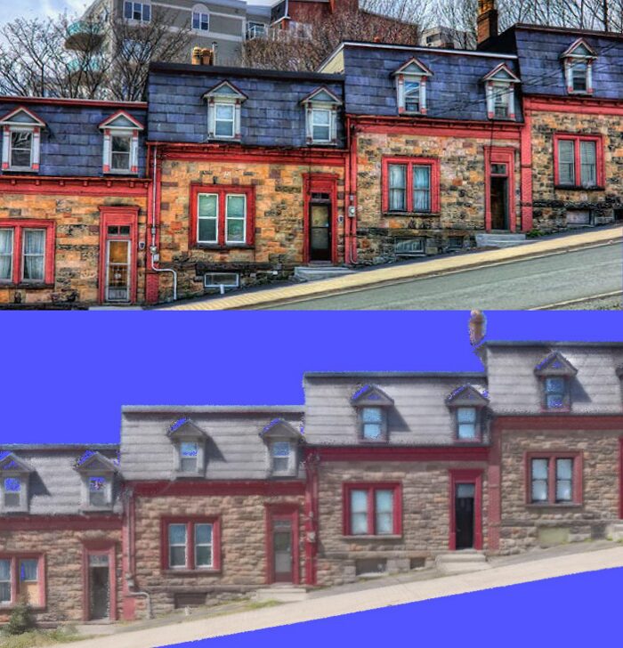
The iconic Four Sisters row houses in St. John’s, documented as part of RCD TAC’s ongoing efforts to preserve the province’s historic urban architecture.
Built by master stonemason Samuel Garrett as wedding gifts for his four daughters, the Four Sisters Row Houses have overlooked St. John’s Harbour for more than a century. Today, these distinctive stone homes remain one of the city’s most treasured architectural landmarks.
Learn More: https://www.historicplaces.ca/en/rep-reg/place-lieu.aspx?id=12901
Check out the full playlist for even more clips!
The man behind the map
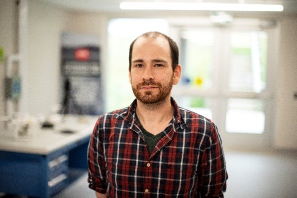
As RCD TAC’s collection of digitally documented heritage sites continues to grow, so does the need to organize, visualize, and manage that information. John Miller, Cartographic Technician III with RCD TAC, has played a key role in mapping and organizing the province’s growing digital heritage inventory.
In the following Q&A, Miller shares insights into the development of the map, the realities of capturing heritage sites across Newfoundland and Labrador, and how emerging technologies could help make the province’s history more accessible in the years ahead.
Q&A with John Miller
What was the original purpose of creating an interactive heritage map?
John Miller: The map started as a practical tool to help us organize and manage the growing number of heritage sites being documented across Newfoundland and Labrador. As the project expanded, it became an important resource for our team to track work completed, plan future scanning activities, and visualize the geographic spread of sites across the province.
We also wanted to explore how interactive mapping could eventually help showcase some of the digital assets being created through the project. While storage limitations currently prevent us from hosting and displaying every scan online, we’re exploring opportunities to feature selected 3D models in the future.
What have been some of the biggest challenges in documenting heritage sites across the province?
John Miller: Newfoundland and Labrador’s geography and climate can make fieldwork challenging. Weather conditions such as rain, snow, fog, and high winds can limit when we’re able to collect data, particularly for drone-based mapping.
There are also challenges once the fieldwork is complete. The datasets we create are often very large, which can make storage and distribution difficult. We work closely with property owners and community partners to share the information we collect, but there isn’t currently a centralized system for hosting and delivering all of these digital files.
What do you enjoy most about working on this project?
John Miller: One of the most rewarding aspects is introducing people to technologies they may never have encountered before. Techniques such as 3D Gaussian Splatting are still relatively new, and it’s exciting to explore how these tools can be used for heritage preservation here in Newfoundland and Labrador.
On a personal level, I also enjoy travelling throughout the province and visiting communities and heritage sites that many people rarely get the opportunity to see. The project provides a unique chance to experience hidden spaces, learn local history, and help preserve these places digitally for future generations.
What opportunities do you see for the project in the future?
John Miller: I’d like to see more of the sites we’ve documented become accessible through interactive online experiences. Being able to view and explore heritage sites in 3D can provide a much deeper understanding of a place than a photograph or map location alone.
As technology and storage capabilities continue to improve, there will be more opportunities to showcase these digital heritage assets, support education and tourism initiatives, and help communities preserve and share their stories with wider audiences.

Students preserving provincial history
The initiative has also created meaningful applied learning opportunities for CNA students, who have participated in fieldwork, scanning operations, data processing, and digital modelling.
In a recent CBC feature, Intern Aaron Russell reflected on the experience:
“Being able to use this technology to help preserve places that are important to Newfoundland and Labrador’s history is something I’m really proud to be part of,” said Russell.
For students, the project provides hands-on experience with technologies that are increasingly used in engineering, construction, environmental monitoring, infrastructure management, and cultural heritage conservation.
A bridge between centuries
What makes the 100-site milestone particularly compelling is the contrast it represents: centuries-old churches, bridges, convents, root cellars, and wartime spaces being preserved through 21st-century digital technologies.
A laser scanner may seem far removed from the craftspeople who built these structures, yet the technology is serving the same fundamental purpose: ensuring that what is valuable endures.
As RCD TAC continues expanding Newfoundland and Labrador’s digital heritage inventory, each new scan becomes both a technical achievement and a cultural investment—a way of ensuring that the stories embedded in the province’s historic places remain accessible, meaningful, and resilient for generations to come.
Beyond heritage: technology transforming industries
Although heritage preservation is one of the most visible applications of RCD TAC’s work, the same technologies are transforming many other sectors.
LiDAR, photogrammetry, drone mapping, 3DGS, and 3D modelling are increasingly used in construction, infrastructure, natural resources, transportation, environmental monitoring, healthcare, entertainment, and defence and security. By providing accurate 3D spatial data, these tools help organizations improve planning and decision-making, reduce costs, enable remote monitoring, enhance public safety, and support more sustainable operations.
These capabilities align with Canada’s priorities around resilient infrastructure, digital and AI-enabled innovation, climate adaptation, economic competitiveness, and technology-driven job creation.
Part of a national innovation network
RCD TAC is part of College of the North Atlantic’s Office of Applied Research and Innovation and is a proud member of Tech-Access Canada, a national network of more than 70 Technology Access Centres located at nationally accredited colleges, CEGEPs, and polytechnics across the country.
Through this network, RCD TAC collaborates with partners nationwide to help businesses, communities, Indigenous organizations, municipalities, and public-sector agencies access advanced technology expertise, applied research support, and innovation solutions that address real-world challenges.
RCD TAC website: https://www.cna.nl.ca/research-and-innovation/rcdtac/